Friends Summer Events 2010 -- 134th Anniversary of the Battle of the
Little Bighorn
by Bob Reece
All photos © Bob Reece unless
otherwise noted.
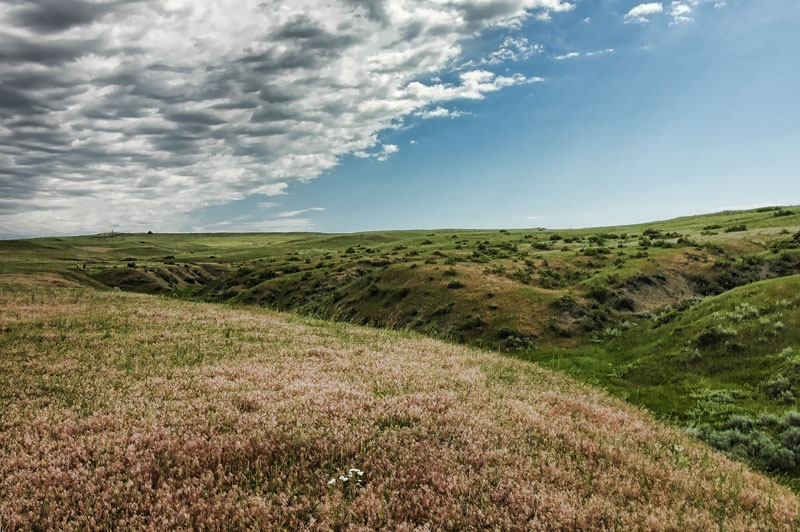
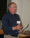
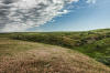
Deep Ravine Trail, Custer National
Cemetery, and Last Stand Hill loom over Friends members Hank Pangione and
Carol Near
Friends of the Little Bighorn Battlefield held its annual events from June
25-26, 2010 at the Little Bighorn Battlefield National Monument (LIBI).
From all reports, everybody had an incredible time – no kidding!
Members and volunteers started showing up first thing Friday morning at
our command post in the old theater in the basement of the visitor center.
It sounds like Friends hangs out in dark basements but that is far
from the truth. We have easy access to our partners on the staff of the
Park Service in the same building; the visitor center is always the hub
for all events, and we are centrally located for volunteers to work the
trails so, it all works well.
Our volunteers interpreted along the Deep Ravine and Keogh/Crazy Horse
Trails, Last Stand Hill, and Reno-Benteen Battlefield. As always they did
a magnificent job and this year were managed incredibly well by the new
Friends Den Mother (Joanne Blair).
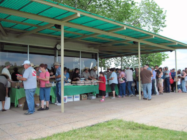
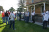
The Park Service was ambitious this year with plans to feed lunch to 2,000
people on the patio of the visitor center. The Friends members who were
not working the trails assisted in the big feed. I’d like to personally
thank the following members for going beyond the call of duty: Ruth Rhode
and Joanne Blair who assisted in the food line as well as Ken and Noah Obermiller
and Rodney Bridgers who hauled the food from the visitor center basement
to the patio.

NPS Feed, June 25, 2010
Photo courtesy of Joanne Blair
Historian Thom Hatch and Friends Annual Fundraiser
Friday evening, Friends held its annual fundraiser on the second floor of
the administration building. Our speaker was writer Thom Hatch and he was
fearless. He’s a former Marine who witnessed his share of action in Vietnam and he
uses that experience to interpret Custer’s Last Stand. He was adamant that
Reno had disobeyed orders, which caused the failure of Custer's plan of
attack. Yes, there are those
who believe Reno had a lot to do with the defeat of the 7th Cavalry 134
years ago, but there are just as many who think not.
I knew those in the audience really enjoyed Mr. Hatch’s presentation for
two reasons: first, he spent about 25 minutes presenting, but followed
with more than an hour of questions and answers. I had to finally ask everyone to leave before the
Monument closed. Second, many people approached Mr. Hatch to personally thank
him for the great program. I wish to thank Mr. Hatch for taking the time
to come to the battlefield and speak before our group.
You can also visit his
website to learn more about Mr. Hatch and his upcoming books.
Thom Hatch
Photo courtesy of Scott Burgan
Friends Feast and General Membership Meeting
Saturday evening we held our annual Friends Feast and general membership
meeting behind the administration building on the battlefield. The Feast
is our way of saying thank you to our trail volunteers. Returning for the
second year was Julie Elkshoulder, owner of Elkshoulder Catering &
Concessions, who provided superb Indian Tacos made from scratch with fresh
ingredients. She also prepared vegetarian plates on request. Joining us
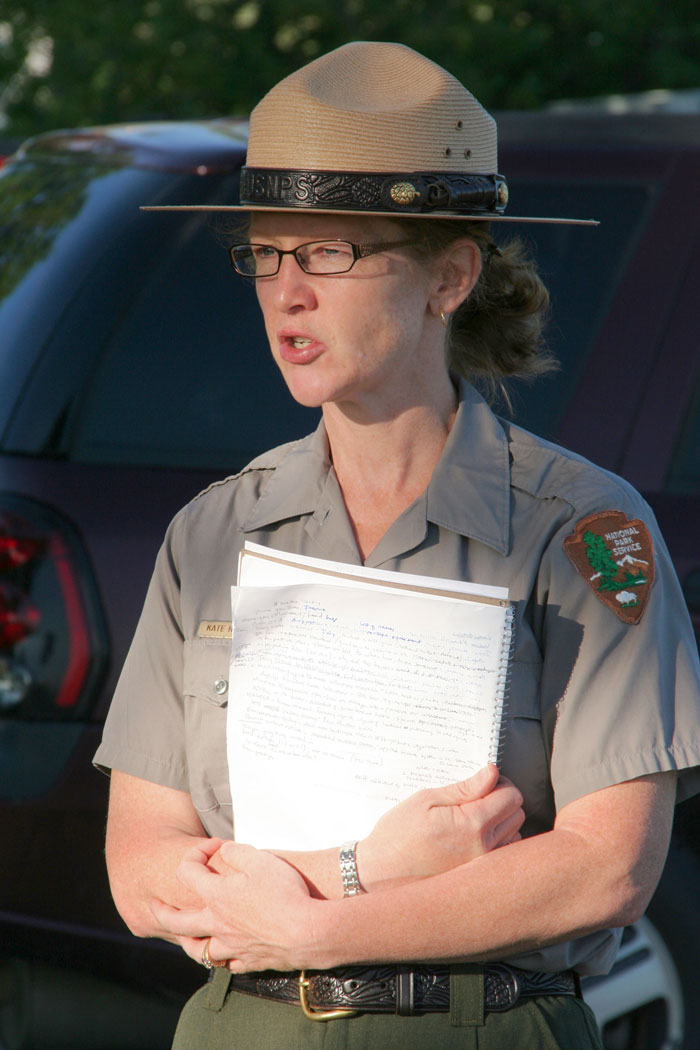
was Superintendent Kate Hammond, who mingled with the membership and
enjoyed dinner with us.
During the general membership meeting, Ms. Hammond personally announced
and thanked each volunteer by name. She also brought us up to date on the
latest battlefield news. To show our gratitude to Ms. Hammond, I presented
her a polo shirt and jacket with the Friends logo and name.
Superintendent Kate Hammond at
the General Membership Meeting
Photo courtesy of Scott Burgan
I also addressed the membership with the latest news from Friends. I
thanked Ms. Hammond for allowing us to take the great field trip “Deep
Ravine Trail & Beyond” (more on that below). Her response was an open
invitation for us to have another field trip next year which we are
already planning.
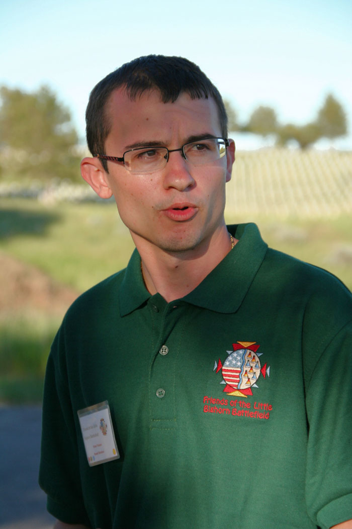
Our newest board member, Ryan Trainor, announced the future publication of
our first scholarly journal, “Ghost Herders”, due next year. Friends
board member Neil Mangum is senior editor, with Ryan as assistant editor.
The essays will include the following subjects:
1) Dr. Douglas Scott will write a summary of the archeology and its
significance on the battlefield and the park story.
2) Jerome Greene will cover the early attempts at living history
interpretation at the battlefield.
3) Park Historian John Doerner will enlighten us with the history of the
Custer National Cemetery.
4) Neil Mangum presented at the Friends' second symposium in 2002,
“Changing Faces of Last Stand Hill.” We will include this outstanding
presentation.
5) From over the pond, Kingsley Bray, author of the book “Crazy Horse”,
will share his views on Crazy Horse at Little Bighorn.
We are looking forward to the publication that will be available in the
visitor center bookstore.

Board member Ryan Trainor announces
Friends first scholarly journal
Photo courtesy Scott Burgan
Bob Reece and Superintendent Kate Hammond Renew MOA
Ms. Hammond and Bob Reece then signed an extension of the Memorandum of
Agreement (MOA) for another year until we can complete the task of a
complete rewrite of the MOA. This rewrite is being coordinated by Krista
Muddle, Regional Partnership Coordinator in the Denver Regional Office.
Friends of the Little Bighorn Battlefield and LIBI signed their first
Memorandum of Agreement in 1998 when Rick Meyer was president and Neil
Mangum was superintendent. For the last 12 years, Friends and management
at LIBI have maintained a close and trusting relationship that neither
party take lightly. I would also like to add that even though we do not
have a formal agreement with Western National Parks Association (WNPA) --
which manages the bookstore at LIBI -- Friends and WNPA also have a
positive working relationship.
Friends Field Trip “Deep Ravine Trail & Beyond”
Saturday morning brought cool temperatures and cloudy skies, all perfect
for our first field trip. Last year, Hank Pangione asked if we could do
something together as a group. Although Hank loves working the trails
(always Keogh/Crazy Horse), he missed not being with others of the Friends
membership. Ironically, Friends member Rodney Bridgers suggested last year
that we have field trips; he wished to see what was beyond Deep Ravine. I
asked Superintendent Kate Hammond for permission; she thought the idea
great, but she wanted to discuss it with her staff. The result was the
Friends of the Little Bighorn Battlefield first field trip “Deep Ravine
Trail & Beyond”.
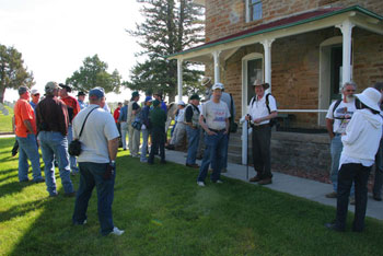
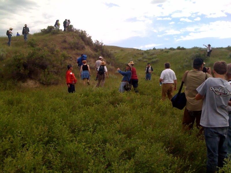
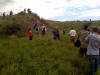
We begin the field trip at the
Stone House
Photo courtesy Scott Burgan
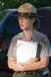
Starting from the Stone House at 9:00 AM, we were led by Park Ranger and
former Friends board member Jerry Jasmer. We walked part way down the maintenance
road behind the staff housing when we turned south across the open flats
towards the Deep Ravine. Somewhere along these flats, or behind where we
walked (according to Mike Donahue), Col John Gibbon would have traversed over
these grounds to make his way up to Last Stand Hill to see the
battlefield for himself. We made our first interpretive stop (see point B
on Map A) where Mr. Jasmer explained the probable route of Gibbon’s
investigation of the battlefield on June 29, 1876.
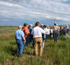
Everyone's attention is on Jerry
Jasmer
Photo courtesy Scott Burgan
The morning of June 29, 1876, surviving members of the 7th Cavalry and the
soldiers under Terry and Gibbon were busy taking care of the wounded
soldiers of Reno’s command. Most were constructing mule litters in order
to better carry the wounded down river to meet up with the steamer Far
West near the junction of the Bighorn and Little Bighorn Rivers. With 50
wounded safe on board, Captain Grant Prince Marsh sailed his magnificent
ship down the Bighorn to its junction with the Yellowstone River. Turning
east, the Far West used its steam engine and the fast moving current of
the Yellowstone to meet the Missouri where it eventually reached its
destination of Ft. Lincoln near Bismarck, Dakota Territory. The 700 mile
trip was made within 54 hours, an amazing record that still stands today.
Days and weeks before we even stepped foot on the battlefield, I was
concerned with the ability of some to make this walk in its entirety. I
knew the first part – the flats – would be easy; it was the crossing of
the Deep Ravine from its west to east rim and the walk beyond that
concerned me. Jerry Jasmer and I had time to discuss this Friday morning.
I’m sure Jerry loved it, but I would like to thank him for taking a lone
scout to the ravine Friday afternoon in order to find a possible crossing
place, which he did.
Our oldest walker was Cricket Bauer’s mother, Rita McCann, who is a very
fit 70 years old. Steep banks of the river became more prominent as our
line extended even more. Leading the pack, Jasmer started turning us
southwest as the steep banks passed beside us, and there was Rita ahead
of many!
Our second interpretive stop (Point C on Map A) was the Monument’s fence
line. The Little Bighorn River flowed about 50 yards beyond the fence.
Just out of view was the oxbow that Dr. Douglas Scott planned to survey
the week of July 11, 2010, which was supported through partnership funding
from the National Park Service and Friends of the Little Bighorn
Battlefield. It was a great photo op for all of us with the mouth of Deep
Ravine to our left.
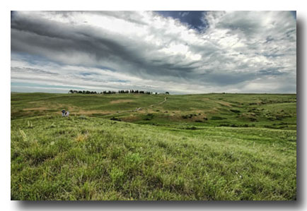
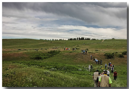
Moving on, we reached the objective of the field trip: the mouth of Deep
Ravine. (Point D on Map A) This mysterious place -- the entire length of
this deep and wide ravine -- beckons me to return to the battlefield year
after year, decade after decade. Its never-silent voice shelters secrets
that will always remain ambiguous, and it boggles the mind. The enigma of The
Battle of the Little Bighorn is like a wheel with countless spokes that
reach out for answers; at its hub is the Deep Ravine.
The Deep Ravine reaches for Last
Stand Hill seen on the horizon
All of us were -- and remain thankful -- for the rare opportunity to visit
this place. Behind us, the ravine ran almost on a straight line towards the
7th Cavalry Monument on the horizon. Immediately below us was the mouth
with its steep drop to the river. Our brief moment here filled us with
wonder: the air was quiet and still, the river ran silent, and we felt the
presence of the warriors and soldiers who fell here.
We were careful to take our time and enjoy this place. Mr. Jasmer let us
soak it in and answered individual questions. When it was time for us to
return, we turned north to follow along the west rim of the ravine. The
sky darkened and the air began to smell of rain. From my decades of
visiting the battlefield in June, I would much rather deal with cool
temperatures and rain (as long as it is not a unique Montana thunderstorm), rather
than Montana heat.
We followed footsteps of past warriors who used these same paths to enter
the battle. Some believe Crazy Horse led warriors through here using the
Deep Ravine and other coulees to better conceal his approach and
ultimately make his surprise charge upon the solders. Most are only
accustomed to gazing upon this portion of the battlefield from Last Stand
Hill or Battle Ridge. From that perspective visitors and battle
enthusiasts cannot fully appreciate the warrior and soldier experience in
this portion of the battlefield. We did.
About halfway between the mouth of the Deep Ravine and the end of the
Deep Ravine Trail, Mr. Jasmer brought us to our crossing point. (Point
E on Map A) The east rim is extremely rugged, but this spot seemed the best
place to cross. As we descended into the ravine, we could see immediately
to our front and right that the Deep Ravine meets with a second Deep
Ravine and that if followed, it would eventually bring you to Calhoun
Hill.
It is like a maze inside this ravine yet we have had the advantage of aerial
photographs and maps to show us the way. As we passed through the middle
of the ravine the earth seemed to swallow us whole. To our front were the
precipitous bluffs of the east bank. It was not difficult to appreciate
the situation the soldiers from the Custer command found themselves in within
this ravine. For them, the Deep Ravine meant nothing but death.
My original intent was for us to travel south after crossing but I had
forgotten how rugged the entire east rim is. As we began to move down the
west bank and into the ravine, I asked Mr. Jasmer if I could reconnoiter
that part of the east ravine to see how things looked. After climbing and
looking south, I could see nothing but more rough terrain so I decided
that we should follow Mr. Jasmer north.
We cross from the west to the
east side of the Deep Ravine. Bob Reece at upper right directs people to
follow Mr. Jasmer north
Photo courtesy Cricket Bauer
We did not have far to trek when we came upon a lone soldier grave marker
number 257. (F on Map A) Thanks to Friends member Dale Kosman for pointing me to Doug
Scott’s book, They Died with Custer which has information about this
marker. On page 53 Scott writes, “Marker 257…did yield a few human bones.
The bones of a hand and foot were badly eroded, suggesting that they had
lain on the ground surface at some time in the past. While the bones can
be identified only as adult human, this marker location is identified in
the Camp notes and on his marker map as the site where Company F’s
Corporal John Briody’s body was found. According to Camp’s notes, Briody
was found with his leg severed from his body and placed under his head...That marker 257 is the site of John Briody’s burial must remain
speculation and an intriguing possibility.”
Open Walter
Camp's map with added notes from Francis Taunton's Custer's Field: A Scene of
Sickening Ghastly Horror for location of Briody's body. Map
used with permission of Francis Taunton.
Note: Original Camp map is located in Walter Mason Camp Collection at
the Harold B. Lee Library, Brigham Young University, Provo, Utah. For further reading about
the possibility of Briody's remains being seen in 1876 and to view more Camp maps,
read Michael Donahue's book,
Drawing
Battle Lines.
We lingered here for some time. It was impossible not to stop and gaze
upon this marker and wonder. From the vantage point of marker 257, we had
a beautiful view of the Little Bighorn River and its valley. Was this the
last view for a solider all alone? How did he arrive here only to find his
ultimate end?
When I arrived home after our visit to the battlefield, I pulled out the
huge map that accompanies Doug Scott’s book of the 1984 dig,
Archaeological Insights into the Custer Battle. One side of the map
documents the thousands of artifacts found during the dig, but the
opposite side shows the location, of all the soldier markers. This is not an easy map
to read because there is no overlay of the battlefield. One either needs a map of
the battlefield near him, or to know the ground personally to best follow the map.
What I saw was intriguing because as is mostly the case with this battle,
answers summon more questions. I have to wonder if this soldier came from
Finley/Finckle Ridge rather than Last Stand Hill. Marker 257 is the last
of a straight line of markers that appear to originate from Finley/Finckle
Ridge and Calhoun Hill. The same can be said regarding the troopers that
fell into the ravine only to be found dead by the surviving soldiers of
Reno’s command on June 28th. The soldier at marker 257 might be the last
soldier in a line coming from the vicinity of Deep Ravine Trail. Marker
257 is just one more spoke in that mysterious wheel.
Our little group left behind marker 257 and began a slow, gradual ascent to
the crest of the hill. When I worked at the battlefield as a battle
interpreter during the summer of 1985, I used to walk the east rim of Deep
Ravine often. In those days, I’d follow very narrow foot trails made by
the Monument’s staff.
Those old foot trails are long gone but you can
still see some of them on Map B.
Once we reached the top of the hill, we were surprised to discover just
how close we were to the Deep Ravine Trail and familiar ground. From near this vantage point we could look down at the end of
the Deep Ravine Trail and the wayside that Friends donated to the
battlefield. We knew this incredible experience was coming to an end.
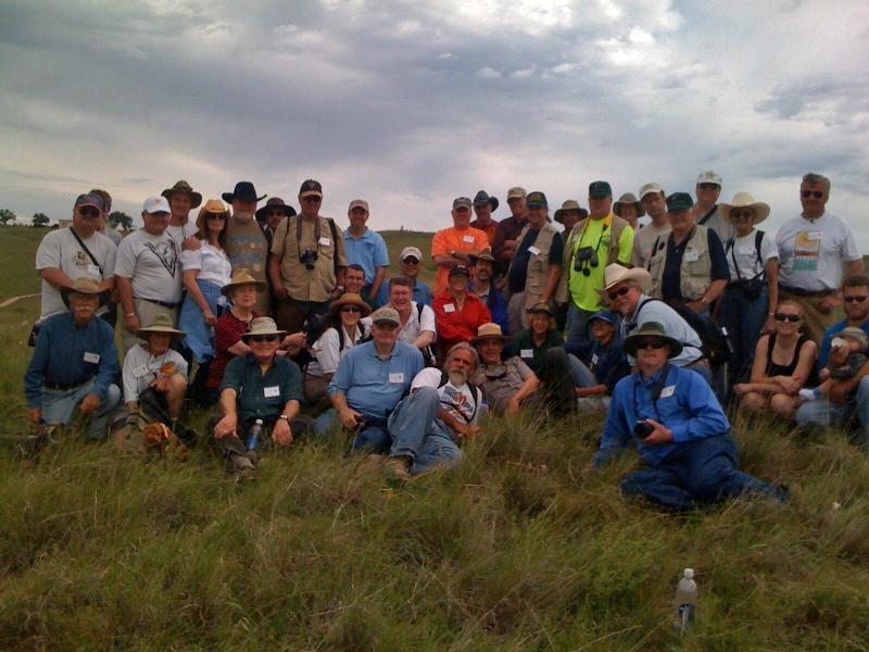
Every person had a great time. There were lots of laughs, great
conversations, and fantastic photo ops. Cricket Bauer had a great idea to
shoot a group photo. That was a fun experience by itself. There
we all were, posing for one great group photo with Last Stand Hill in the
background. (Point G
on Map A)
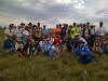
Our
group photo taken by Cricket Bauer using her IPhone
We then descended downhill to meet up with the Deep Ravine Trail. There we
all had a chance to thank Jerry Jasmer for a wonderful experience and a
job well done. (Point H on Map A)
This first field trip of the Friends of the Little Bighorn Battlefield was
more than a success; it was a thrill and one that none of us will ever
forget. I used our website and Facebook page to publicize the field trip,
resulting in the field trip being fully booked by February. Technology is a
wonderful thing and we took advantage of it to post photos of our field
trip during the walk itself. Thank you Cricket for doing that. If you were
not able to make the field trip, but were a member of Friends on our Facebook page, you could have been following along during the event.
Please keep that in mind next year when we have our second field trip,
date and time TBD.
Next time you have the chance to walk to the end of the Deep Ravine Trail,
I hope that this report of our field trip will help you imagine what lies
beyond. Like the dark side of the moon, we rarely go there and it remains
a mystery.
I’ll see you on Last Stand Hill.
(Back to Top)
|