Friends Of The Little Bighorn Battlefield

The Next Generation In The Study Of Custer's Last Stand

Home • Join Friends • Point Click Give • Guestbook
 

Unraveling Riddles in the Shadow of Sharpshooter Ridge With Michael Donahue


"Unraveling Riddles in the Shadow of Sharpshooter Ridge" With Michael Donahue

By Mike Semenock, Friends Board Member

All photos © Bob Reece unless otherwise noted

"He died right here; right where I’m standing. He’d shot three men of Company M as they lay prone 600 yards away and below him, where the routed soldiers were now surrounded. He must have smiled after each shot before once again turning stony-faced as he peered down the sights of his rifle. Suddenly eight bluecoats sprang up, turned his way and fired, and the warrior fell silent.

I was standing beside a small rock cairn on the south end of Sharpshooter Ridge. This could be the exact spot where the Indian sharpshooter, who gave this ridge its place name, was killed in a volley from Capt. Thomas French, 1st Sgt. John Ryan and a half dozen of their comrades.


Rock cairn on Sharpshooter Ridge, Weir Point in distance

Back this year, this time the sole leader of our field trip, was Park Ranger and Little Bighorn Battle Historian Michael Donahue. When not speaking to spellbound summer audiences at the battlefield Visitor Center, Donahue is a college art professor and department chairman, artist and author. His first book, “Drawing Battle Lines-The Map Testimony of Custer's Last Fight" was published in 2008 by Upton and Sons. On this balmy evening, as we ambled along Sharpshooter Ridge, Donahue presented a unique analysis of battle events that substantiate the provocative theories to be divulged in his next book.


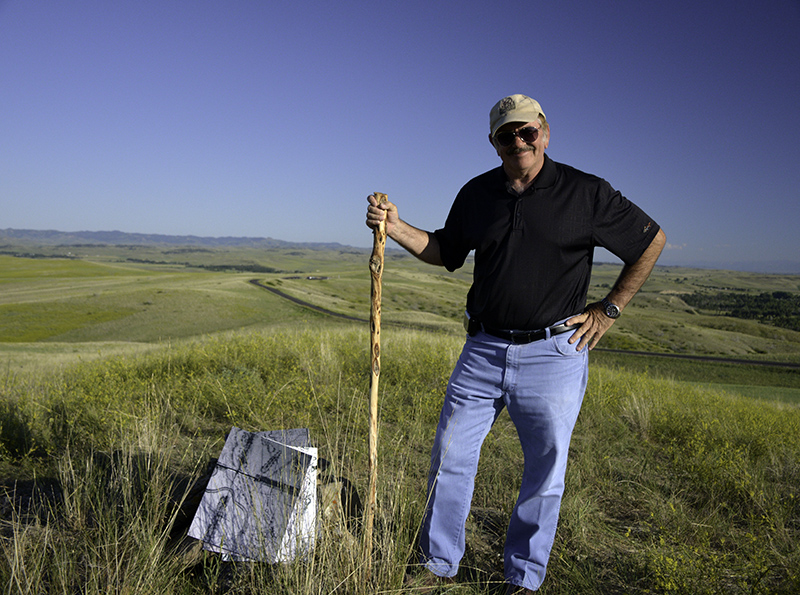
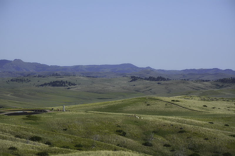
Michael Donahue beside his maps and the rock cairn on Sharpshooter Ridge,

Reno Benteen Battlefield in distance


The title of this year’s field trip, “Unraveling Riddles in the Shadow of Sharpshooter Ridge,” is somewhat misleading. We were not in the shadow of the ridge; we walked along much of its crest. Because the spine of the ridge is one of the highest elevations on the battlefield, it offers a remarkable perspective of other familiar landmarks. From the warrior view, looking down on the Reno-Benteen defense area, one is struck by the entirety of exposure and near defenselessness of the site. Surely desperation and exhaustion had more to do with the decision to hold there than did tactical expediency.


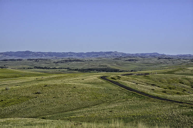
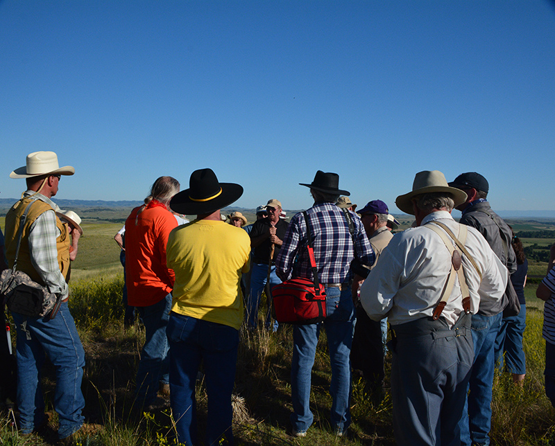
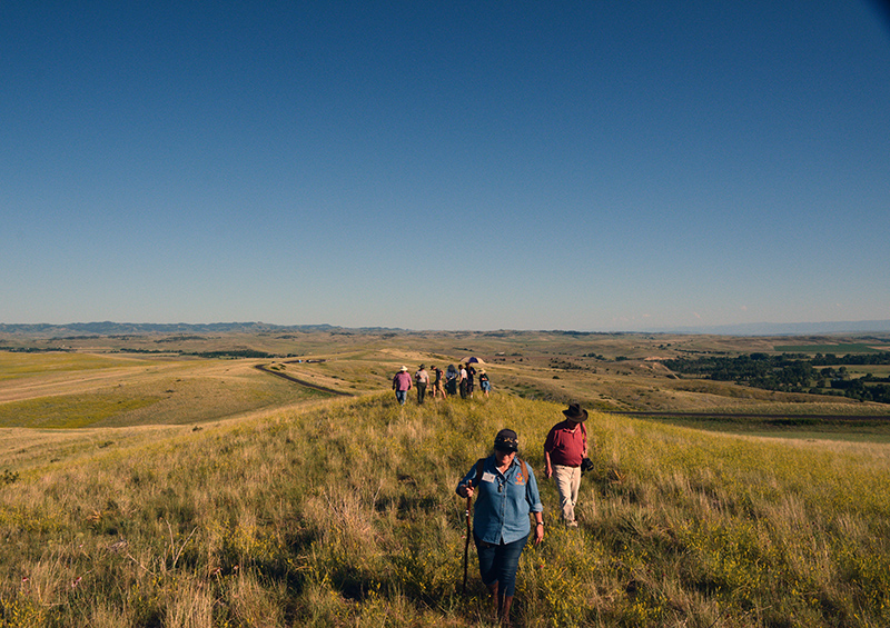
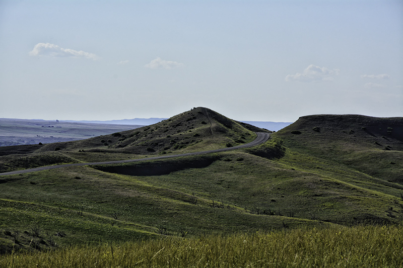
Reno-Benteen defense area from Sharpshooter Ridge

Wolf Mountains in distance

Because the crowd of more than sixty was to assemble where there is no parking, participants were transported by tour bus in two runs from the Visitor Center to a pull-out below Sharpshooter Ridge. When the bus arrived with the second group, they filed out the door, joined the first riders and spread along the shoulder of the loop road. As we began the ascent, spread out behind him, Donahue suggested we narrow up. “If you form a skirmish line, you’re bound to find a rattlesnake. Form a line and let those in front find them,” he quipped.


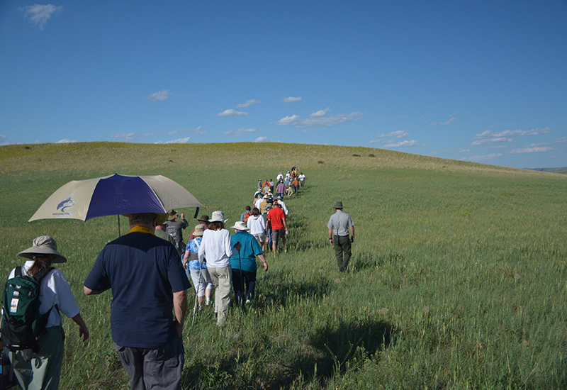
The line walking up to Sharpshooter Ridge

Donahue stopped to begin his talk and the attentive crowd spread out, eyes on the ground, treading cautiously, and gathered around him. For the next hour he tantalized us with tidbits of primary accounts regarding the battle and its aftermath. He’d pull his audience into the discourse with thought provoking questions and challenge them to reconsider generally accepted assumptions. I can’t replicate here the experience or the presentation, but I can relate a few particulars. Suffice it to say I came away eager to get hold of that new book. (Webmaster Note: As of this writing, there is no publication date set for Mr. Donahue's book)

Donahue set the scene in the valley below where Custer’s command watered their horses near Reno Creek. The soldiers said they saw about fifty Indians on what would later be called Sharpshooter Ridge. Donahue told us a rancher, who had been in the Reno Creek Valley since about 1960, showed him the still-visible ruts of a travois trail that ran from the valley up to below the ridge. Alongside the trail was once a natural spring that stopped flowing decades ago after some blasting was done nearby. Could this be where Custer watered his horses before following the Indian trail to where we now stood?


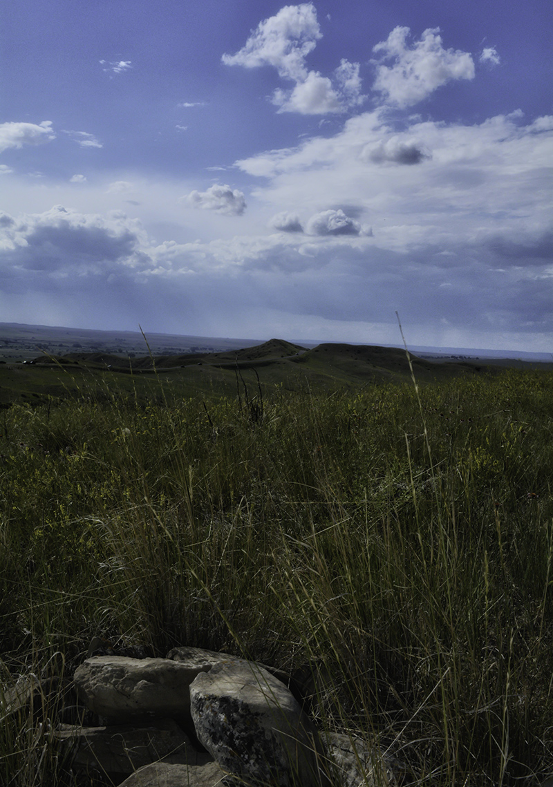
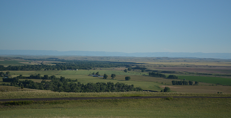
The valley beyond the Reno-Benteen defense area
 

Atop the ridge Donahue stopped by a small rock cairn. Another, farther north along the ridge, was not far away. They could mean warriors died at these spots, Donahue said, or perhaps the rock piles were used as breastworks. “But,” he continued, “the only known photo of an Indian reenacting a sniper here shows him using crossed sticks as a rifle rest.” They sure looked like the other cairns commemorating a warrior’s death to me, I thought.

We all understand the stories behind how this ridge got its name; John Ryan talks of an Indian sharpshooter up here. But Donahue added a few interesting points. Ryan said the sharpshooter hit three men from this location which is above and about 600 yards away from their position. The warrior was lining up his shots along a line of men lying perpendicular to his line of fire. This increased his chances of hitting one of them; nonetheless that’s a heck of a shot. “Some of the tour guides here think it was a woman shooting up here; it’s part of the Crow oral history,” Donahue told us. Then he asked the crowd, “By the way, do you know who named this Sharp Shooter’s Ridge?” A few guesses were offered, and then he told us the first time the name Sharpshooter Ridge appears was on a map drawn by Walter Camp.

Trumpeter John Martin said that after climbing to the base of the ridge, they stopped and looked out over the valley and that location was about 300 yards from the Reno-Benteen defense site. The Crow scouts would later say that the location was near the Lt. Benny Hodgson marker. The Hodgson marker has since been relocated below the bluffs and near the river, but at the time the Crow shared their accounts it was just below us near the pullout where our tour bus was parked. From where we stood, on the south end of the ridge, Custer could see about two thirds of the village. The Cheyenne camp, at the downstream end, would have been obscured by Weir Point.


Looking south up the Little Bighorn valley as seen from Sharpshooter Ridge. The bluffs on the east side of the river hid the Indian village from Custer's view


At this point a messenger from Reno rode up with a message saying droves of Indians were chasing Reno and his men. But Custer couldn’t see any Indians in the dust-clouded valley and wondered what the hell he was talking about. Martin said he didn’t see any of Reno’s men down below. In what could be seen of the Indian village, they could discern only women, children, dogs and ponies scurrying about. At this point some of the Crow scouts encouraged Custer to go down and attack the village, but Mitch Bouyer cautioned that the warriors were, indeed, down there.

Next Donahue apprised us of the significance of the grassy slope on which we stood: so many impactful decisions were made here. We tend to look at the events of the battle in terms of what we know from contemporary accounts and popular theories, but keep in mind that Custer knew very little at that moment. Though often derided for not going to Reno’s aid, at this point Custer did not have confirmation of Reno’s predicament, and he had no idea how many warriors may be behind the ridge or farther along the trail. If he descended to the valley and followed Reno, he may have found warriors closing in behind him, or they could get between Custer and the pack train. So, beset with his own dilemma, Custer decided to follow the Indian trail.

Panoramic of north end Sharpshooter Ridge, and Weir Point.
 

According to an Arikara scout named Soldier, here Custer took off his buckskin coat and put it on the back of his saddle. Custer then rallied the troops with a wave of his hat and shouted, “We’ve caught them napping, boys! Let’s finish up and return to our station.” Soldier soon went back and did not continue with Custer, but he left us this great eye witness account of the men getting ready to go into a fight, “The men began throwing away their hats and wrapping their heads with bandanas.”

It was also at this point that Daniel Knipe was sent back with a message for the pack train. He had no way of knowing where Custer went from here.
 

"For the next hour he tantalized us with tidbits of primary accounts regarding the battle and its aftermath."

Donahue seen in the center


“A lot of stuff happened here quickly;” Donahue said, “they needed a stoplight.” Knipe leaves with Custer’s message to find the pack train, Arikara scouts ride up with stolen horses just as Knipe rides off. Custer and the scouts climb Weir Point and for the first time see the full expanse of the Indian village and Reno’s dismount in the valley. Curley heads off, his scouting duty fulfilled. Martin later comes back over the high ground with his message for Benteen. Boston Custer passes Martin and follows the command’s trail through this area toward his brothers and his fate.

Someone asks where Peter Thompson was. “Thompson’s up here too,” Michael said, “but not down with Custer. He saw Custer go down over the hill, not down Cedar Coulee.”

Melani Van Petten and others on Sharpshooter Ridge


It was Curley who said that Custer’s command traveled down Cedar Coulee from the bluffs and Martin, forgetful or lying, agreed with him. However, in the years following, Curley’s story would change time and again, and his maps were different each time he made one. Henry Weibert said metal detector surveys of Cedar Coulee found no evidence to support this version of the events. Other accounts have the trail going through the saddle of Weir Point (since cut out by the road) and down the slope of the bluffs. In an unpublished letter, French said Custer’s trail went over the saddle of the high ground, meaning the swale between the heights of Weir Point. “So,” Donahue said, “if you take Curley’s account out of the equation, all these other accounts begin to make sense.”
 

"Custer's trail went over the saddle of the high ground."


When Custer gets to Weir Point he and the scouts climb to the top. Here he sees Reno’s dismount in the valley. The command then travels down to the river. Martin is sent back with Cooke’s written message for Benteen. Martin said that as he rounded Weir Point, he saw Reno’s retreat. Now Donahue gave us something more to think about. He said that he and George Kush once timed a rider taking two possible routes used by Martin on his way back from Medicine Tail Coulee to the bluff below Sharpshooter Ridge. He said that for Martin to ride up the slope to where he saw Reno’s retreat takes a rider thirteen minutes. If he had ridden back up Cedar Coulee, it would have taken twenty-four minutes and Reno would already have been in the timber.

Toward the end of Donahue’s talk, the crowd perked up when he said, “A soldier in buckskin was killed at the river and it wasn’t Custer.”

“Sturgis?” someone surmised.

“It might have been Sturgis,” Donahue replied equivocally. The crowd went silent with anticipation, but erupted in laughter when he said, “You’ll have to wait till my book comes out.”

As we started down the slope to return to the tour bus, Melani Van Petten - who could have been speaking for all of us - told Donahue, “You made my day.”

Carol Near, Nancy Marteney, Joanne Blair, and a well-hidden Jim Thorn

on the tour bus heading back to the visitor center.

"What a great field trip!"


(Back to Top)

2015 Summer Events

Summer Events Home