| Friends Of The Little Bighorn Battlefield |
The Next Generation In The Study Of Custer's Last Stand |
Changing Faces Of Weir Point |
| • The Battle • Archeology • Memorials • Little Bighorn Store • News • Book Reviews |
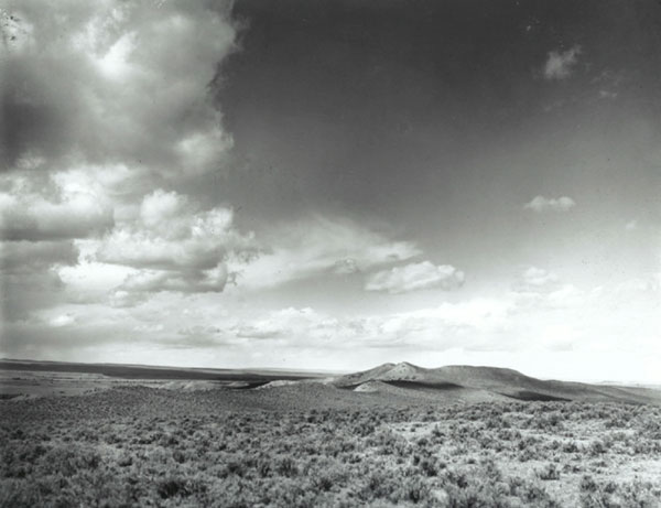
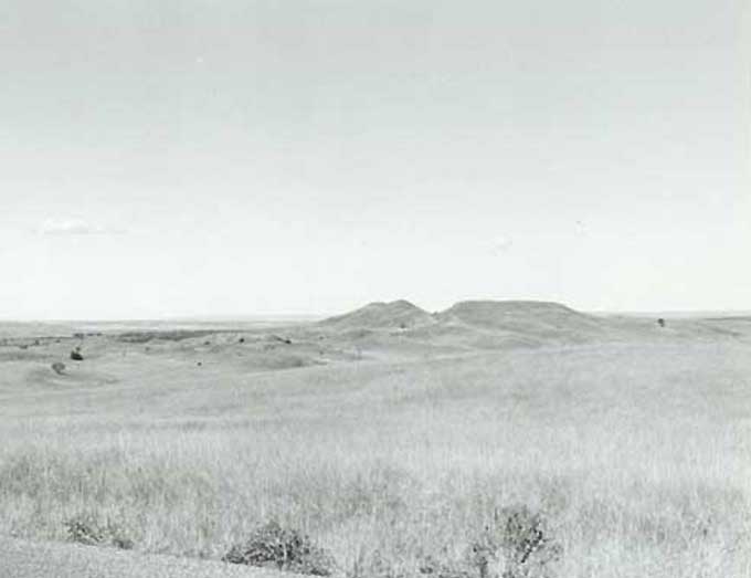
Photos by Lee Moorhouse and James BrustIn 1938 the War Department constructed the battlefield road that runs from Last Stand Hill to the Reno-Benteen Defense Site. Instead of building the road over or around Weir Point, it was decided to cut through it. It is interesting to see how the landscape changed as a result of the road construction. In 1901 Lee Moorhouse took photos of Weir Point while visiting Custer's Battlefield. In 1995, Friends' member Jim Burst took the same photo of Weir Point from near the same spot. Next time you read accounts of the soldier's excursion to Weir Point and their description of it, you might want to visit this section of our website. The Moorhouse photo is the first photo shown here courtesy of the Division of Special Collections and University Archives, University of Oregon library system. We also wish to thank Jim Brust for allowing us to use his photo which is the second one below.
Photos Home |
|
Copyright 1999-2013 Bob Reece Friends Little Bighorn Battlefield, P.O. Box 636, Crow Agency, MT 59022 | Home |
Board of Directors |
Guest Book | Contact | Site Map
| |